Showing posts with label Joaquin Miller Park. Show all posts

Monday, December 26, 2016

Oakland Trails: Dimond to Chabot

Yesterday, K and I joined Stan Dodson and a small, hearty group to hike from Dimond to Chabot Space and Science Center. Stan is the manager of La Farine Bakery on Fruitvale where we began the hike. But he's also the founder of OaklandTrails.org and the producer of the documentary Trailhead: Discovering Oakland's Gateway to the Redwoods. We were joined on the hike by local historian (and Legendary Local) Dennis Evanosky, who is also part of the documentary.

It didn't take long from our start before we were in Dimond Park. There we got our first look at Sausal Creek. A restoration project that was completed earlier this year included daylighting a 180 foot section of the creek that had been culverted for decades. It's made a huge difference in the park, adding both the to visual beauty but also the support for local wildlife. We continued up the Sausal Creek watershed into Dimond Canyon, and saw some of the projects that the OaklandTrails.org volunteers have been involved in. Stan's fundraiser for the Trailhead documentary was so successful that he had some money left to have trail markers made for the route, too. Which is a good thing, as the route takes a few non-obvious turns.

We stopped at various points to catch our breath, hear some info from Stan or some history from Dennis, or just admire the views. Even with the stops, we finished the 5.5 mile, 1,500+ foot climb in about 2.5 hours. At Chabot, we hopped on an AC Transit bus for a 10-minute ride back to our start on Fruitvale Ave. It's amazing to have such a beautiful, natural area within the bounds of Oakland, and that can be reached on foot, by transit or by car. From the trails near Chabot, you can connect to hundreds of miles of trails, including the 550-mile Bay Ridge Trail.

Stan leads the hikes not just for the general public, but for school groups, after-school programs and others. And OaklandTrails.org does trail maintenance, patrols the parks to help users and looks for fallen trees and other hazards, and works to improve the trails. To donate or volunteer, check out OaklandTrails.org to learn more. You can watch the Trailhead documentary there, too. You don't need to wait for one of Stan's guided hikes, though. Maps are available online, trail markers are there, so get out and explore some of the natural beauty here in Oakland!


See the photos full-size here.

Monday, October 13, 2014

Oakland Urban Paths: Butters Canyon


We had a good turnout and perfect weather for Saturday's walk in Butters Canyon with local historian Dennis Evanosky. We started our walk in front of fire station 25 on Butters Drive shortly after the morning fog burned off.

As we wound around the hills, Dennis told us some about the history and geology of the area. Of particular interest is the California state rock, serpentine, which is common in this area of the hills. Soil formed from serpentine tends to be poor in calcium and rich in things toxic to plants, so plants and trees grow sparsely. When poet Joaquin Miller first came to the area, the hillsides of what are now Joaquin Miller Park were largely bare. Miller planted thousands of trees, including oaks, redwoods, and the less popular eucalyptus and acacia. A number of streets in the area are named for Oaklanders who died in WWI, including Butters, Brunell, and Burdeck.

We stopped by the Naturfreunde, an Oakland German-American group. It started back in the 1920s as a strictly German speaking club, but now is open to all who support nature and Austrian-German-Swiss culture. Nearby we got our first glorious view, looking over Oakland from above Holy Dames University.

Further up Butters, we heard from Dolores, who is both a frequent OUP walk participant and a member of the Butters Canyon Conservancy that has been working since 2001 to preserve Butters Canyon and the local Peralta Creek watershed. With the exception of a couple of "pumpkin teeth" still sticking out, most of the canyon has now been preserved either through acquisition or conservation easements. The group is now working to remove invasive plants and help mitigate fire danger.

Then it was up the hill and across Joaquin Miller Rd. into Joaquin Miller Park. After Joaquin Miller died, part of the land became a city park, The Heights (Miller had called his 75-acre estate 'The Hights'), and part became Sequoia Park, which was home to the Oakland Zoo for a few years. We saw some of the monuments that Miller erected, got another spectacular view, and finished the walk at The Abbey, Miller's former home across from the end of Butters Drive.

Our walk took us briefly near the Woodminster Cascade. Usually the water isn't running in it but it was Saturday, so after the walk I went back and took some pictures. I found out from some OPR workers that there was a wedding scheduled for later that afternoon.

Lots more pictures from the walk and of the Woodminster Cascade:

Friday, March 14, 2014

photo of the week: Joaquin Miller Park


Last weekend the Oakland Urban Paths walk was through Joaquin Miller Park. It's an a amazing place, and it's easy to forget you're in a major city when you're there.

Sunday, March 9, 2014

Oakland Urban Paths: Joaquin Miller Park


Saturday a surprisingly large group turned out for what was billed as "a strenuous and technically challenging walk." Led by Stan Dodson of the Friends of Joaquin Miller Park (FOJMP), about 44 people and two dogs explored the park and looked at trail restoration work that's been done, and some work that still needs to be done.

We met at the bottom of the Palos Colorado Trail, the lowest point in the park, and a section that many people don't know about. After powering up with some tasty treats from La Farine Bakery (Stan is the manager of the Dimond branch), we walked up the trail that parallels Palos Seco Creek. It's one of the main tributaries of Sausal Creek, and always has a least a little water. Since we've had a few good storms (like the one that postponed the walk from last month) there was a nice flow of water and things were a vibrant green.

The trail took us to the site of the former Sinawik Cabin. It was built in 1949 for the Girl Scouts, but was in disrepair since the 1980s, before burning to the ground on July 4, 2013. From there we headed further up hill, along several trails that have been rerouted by FOJMP and other groups like Volunteers for Outdoor California. Still climbing, we went up the Cinderella Trail, where Stan showed us a unique area that showcases all the major ecosystems contained within Joaquin Miller Park.

We took an alternate route hoping to find some open restrooms, but alas, they were closed. The detour wasn't all bad, though, as it took us along one of the most beautiful and most-used trails in the park, the Big Trees Trail. After a bathroom break at another set of bathrooms and a bit of rest, we looped back past the Sinawik Cabin, then out of the park onto Castle Drive. A couple of hard-to-find urban paths and side streets took us to Mountain Boulevard, past the tunnel under highway 13 which connects to Dimond canyon, and back to our starting point.

Another great walk! Thanks to Stan for leading the walk, everyone who came out, and to everyone who donated after the walk. The donations were given to the Friends of Joaquin Miller Park to help continue the great work they've been doing on improving and maintaining the park.

A map of our route (which was a bit different than what was originally planned).

Lots of pictures from the walk:


Links and References

Monday, June 24, 2013

showing off Oakland


Kand I have some family in town (K's cousins from Sweden), so Friday afternoon we showed them around Oakland.

We started in Joaquin Miller Park and Redwood Regional Park to see the redwoods. They had been up near Mendocino and seen lots of larger redwoods, but Oakland's redwoods and their relative youth (less than 150 years old) are part of Oakland history. And it was quite warm, so a shady walk was just the thing to start our afternoon with.

After wandering amongst the redwoods, we headed down the hill past the Mormon Temple and the Greek Orthodox Cathedral through the Dimond and Fruitvale, along the south end of Lake Merritt, and down to Jack London Square.

In Jack London Square we saw Heinold's and talked about Jack London and his writing career. We walked along the waterfront, enjoying the warm sunshine and cool breezes. We checked out the cranes at the Port of Oakland, the USS Potomac, the Lightship Relief, and the OFD fireboat Sea Wolf.

Then we returned home for dinner and more conversation. But our visitors weren't done with Oakland yet—they headed back to Jack London Square to meet up with some other cousins for Dancing Under the Stars!

More photos from our tour:

Tuesday, June 12, 2012

Volunteers Work to Improve Joaquin Miller Park


This past weekend I joined dozens of other volunteers to help improve Joaquin Miller Park. The event was organized by Volunteers for Outdoor California (V-O-Cal), along with the Friends of Sausal Creek and the city of Oakland parks and rec department. There was also a large contingent from the Bicycle Trails Coalition of the East Bay there to work on the trails. V-O-Cal does park improvement projects all over northern California, from the coast to the western Sierra. This project appealed to me because it was a chance to help improve Oakland's largest park, but also a chance to camp there, which isn't normally allowed**.

Volunteers could work Saturday, Sunday or both days, and were allowed to camp Friday and Saturday nights. I elected to stay both nights and work both days to see and do as much as possible. After getting camp set up near the Fire Circle on Friday evening, some of us joined city of Oakland naturalist Stephanie Benavidez for a short walk to hear about the history of Joaquin Miller and the park that bears his name. It's hard to believe now, but when he lived there in the late 1800s, it was relatively barren after the redwoods were logged. Today it's covered in a variety of trees, many of which he planted.

Saturday morning after registration and breakfast, we heard a bit about V-O-Cal and about what we'd be working on, as well as some words of thanks from Oakland parks and rec director Audree Jones-Taylor. Then we broke up into crews of about 10 people each and received a brief safety talk and explanation of the tools we'd be using.

The most common tools for trail maintenance and creation are also some of the most common for fighting wildland fires. First up is the McLeod, a combination heavy duty rake and hoe tool named after ranger Malcolm McLeod. It's great for clearing organic matter for a new trail (or a fire break), as well as clearing loose dirt. Also named for a ranger is the Pulaski, named for ranger Ed Pulaski, US Forest Service ranger, 1910. It's a small adze on one side and an axe on the other. It's good for digging into soil, chopping small roots and branches, and making small adjustments to the tread of a trail. For digging larger amounts or prying up stones, the pickmatic is frequently used. It has a pick on one side and a large adze on the other. There were shovels, too, but the only time I saw one used was when we were trying to dig out an old fence post.

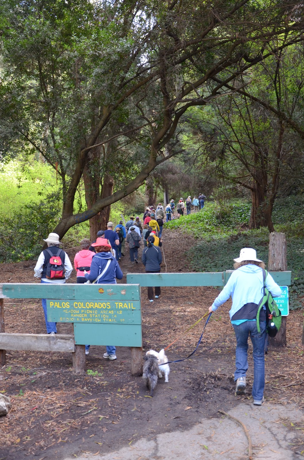
Crews were assigned a section of the Bishops Walk trail in the lower part of the park. Some sections were just widening and smoothing the trail, but other sections were rerouted and involved building a whole new trail. The most difficult of those required building a retaining wall to support a switchback. I was on the crew that was at the top of the trail near Lookout Point. Our section wasn't too difficult, widening the trail and adding some drainage dips, but we also removed the remains of a fence near the lookout and picked up buckets full of bottles and broken glass. Another crew spent the day building a fence near the headwaters of the creek to protect a restoration area.

On Sunday morning, most crews went to a different trail to begin maintenance work. The switchback crew went back to work, and I joined a crew that did touch up work on various areas along Bishops Walk. It was a shorter work day, which was good for those of us not used to using some of the muscles involved.

All in all, it was tiring and dirty, but a lot of fun. Part of why it was fun was because everything was very well organized. Thanks to all the crew leaders, and special thanks to the volunteer project team:
Project Team Leader: Morris Older
Technical: Woody Collins
Kitchen: Lila, Rachel
Outreach: Trina Hudson
Camp Operations: June Nakatani, Joe Lovelace
We ate well, had fun in camp at the end of the work day, and got to hang out with a lot of friendly, interesting people. I'll definitely sign up for more V-O-Cal events in the future. The next one is in Golden Gate Park in August. You have to work hard, and bring your own camping gear, but it's a chance to camp for free while you're working to make Bay Area parks better.

More pictures from the weekend:


** As noted above, camping isn't normally allowed in Joaquin Miller Park. But there is another opportunity coming up in a few weeks, The Great American Backyard Campout, June 23-24. It's a great chance for families that might not otherwise be able to go camping to experience it. Read more on the Oakland Parks and Recreation website.

Monday, May 30, 2011

exploring the Sausal Creek watershed

Sometimes I think I've explored other parts of Oakland better than I've explored the hills where K and I live. When I'm elsewhere in Oakland, I tend to try new routes, go through different neighborhoods, seek out new things. Closer to home, we tend to stick to the same places—I don't know how many times we've hiked the same trails in Huckleberry and Redwood regional parks, or taken the same routes to Montclair Village. So yesterday, K and I decided to hike someplace new.

Many Oaklanders are probably more familiar with the middle stretch of Sausal Creek, where it passes through the Dimond and the topographically named Sausal Creek neighborhood, roughly parallel to Fruitvale Ave. The Dimond has some awesome wayfinding mosaics (featured on Oaktown Art) to point people towards it. But the upper part is fed by Shepherd Creek and Palo Seco Creek, then cuts the Dimond Canyon through Oakmore, draining a large section of the Oakland hills.

We headed to the western part of Joaquin Miller Park, just off highway 13, to one of the upper parts of the Sausal Creek watershed. Looking at some very helpful maps from the Friends of Sausal Creek, it turns out we're actually in the watershed at home. We're on the Shepherd Canyon side of a largish ridge, and Shepherd Creek feeds into Sausal Creek. (Also check out great info on the geology of the area on Oakland Geology.) We started with a short, steep hike up to Visionary Ridge, to a viewpoint favored by Joaquin Miller himself. We hung out there for a while, admiring the sweeping view of Oakland.

redwoods

Then we headed further up Palo Seco creek. There are gorgeous redwoods, which while not as old as the ones in Muir Woods, are every bit as beautiful. The area was heavily logged in Oakland's history, with redwoods being used for ship's masts and building construction, but new trees have grown up since then. We crossed the creek and walked down a narrow trail on the other side.

Eventually we reached highway 13, where the creek temporarily dives underground and under the freeway, and so did we -- there's a pedestrian underpass linking Mountain Blvd. and Monterey Blvd. A short walk took us back into redwoods and a trail following the creek. Near the Montclair Golf Course, Palo Seco Creek joins with Shepherd Creek to form Sausal Creek. From there it flows down Dimond Canyon. We ended our exploration at the Liemert Bridge over Dimond Canyon, but the creek continues through Oakmore, the Dimond and along Fruitvale Ave., with various parks providing access to it.

Sausal Creek joins the estuary

The lower part of the Sausal Creek watershed is considerably less glamorous than the upper part. Just before the creek reaches International Blvd., it goes underground, resurfacing where it drains into the estuary. There's a very small park near the Fruitvale Bridge, and a marker embedded in the concrete to note it's Sausal Creek.

More pictures in my Sausal Creek watershed album:
Sausal Creek watershed