Showing posts with label urban paths. Show all posts

Saturday, December 15, 2018

Oakland Urban Paths: Walk of the Dead


After the smoke from the fires up north forced a reschedule, we had a small but "lively" group for the Walk of the Dead. In addition to clearer skies in December, we also had great weather—sunny and not too warm. After talking a bit about customs around death like the Day of the Dead, a brief glossary of terms, and some of the symbols we might see on grave markers, we headed off.

Our first stop was Chapel of Memories, also known as the Oakland Columbarium. It opened in 1901 as an independent business, but now is run by nearby Chapel of the Chimes. The buildings are mostly full of smaller niches. While a few are tagged "before need", most are occupied.

Just up Howe St. is Oakland's oldest existing cemetery, St. Mary's Cemetery, a Catholic cemetery which started a bit before nearby Mountain View Cemetery. There were earlier cemeteries closer to downtown, but as Oakland grew, they got in the way of development. The Oakland Cemetery (1852-1857) was at 8th and Oak. The Webster St. Cemetery (1857-1867) was between Webster and Snow Park. Most of the residents
moved to Mountain View or St. Mary's c.1872-76, but not all:
An excavating machine hit a metal coffin and spilled the contents: “the left hand and arm
nearly to the elbow protruded from the ground, the hand drooped over gracefully from the
wrist. Portions of the coat and vest were visible, as were the outlines of the face, but over these
still rested a coating of fine earth.”
Oakland Tribune April 28, 1877

After a brief stop at 4460 Howe Street, which was home at different times to a superintendent of St. Mary's, a florist, and a granite and marble showroom, we went in the top entrance of Chapel of the Chimes. That took us into the newer areas, but down some flights of stairs and around a couple of corners, and we were into an older part, which was designed by noted architect Julia Morgan. Five different architecture firms worked on the structure over the years. The oldest part was originally a station for the streetcar which stopped at the top of Piedmont Avenue.

From there it was through the gates of Mountain View Cemetery, but into Home of Eternity Cemetery, a Jewish cemetery run by Temple Sinai. They purchased land from Mountain View in 1865. Besides more familiar religious symbols on the grave markers, there we saw some kohanim hands, which mean the person was of the priestly tribe of Aaron. Leonard Nimoy used a modified version of the gesture as the Vulcan greeting in Star Trek.

Stepping past a row of trees took us into Mountain View Cemetery, which at 224 acres, is by far the largest cemetery in Oakland.

First we went into one of several large mausoleums on the Mountain View grounds, which contains the remains of Oakland city council member Frank Ogawa and his family. He and his wife were imprisoned in an internment camp along with other Japanese Americans during WWII. Their daughter, Nancy Lynne Ogawa, was born in the Topaz camp and died there. That mausoleum also contains the remains of my grandparents, my aunt and uncle, and my aunt's father, Dr. Edward Lundegaard. Dr. Lundegaard served as a surgeon in the county coroner's office from 1946 to 1954, and then was elected coroner in 1954.

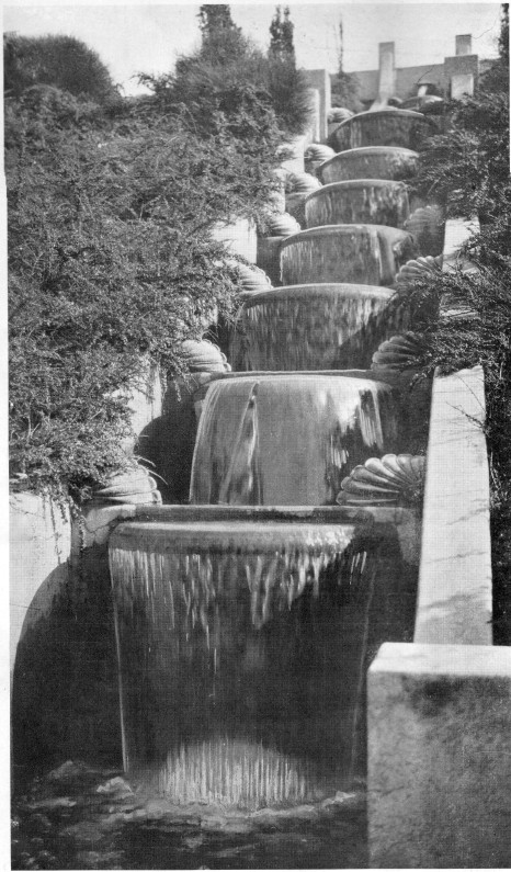
We wound our way up the hill to "Millionaire's Row", where the likes of "Borax" Smith, mayor Samuel Merritt, and the Crockers of Crocker Bank fame are buried in some sizable and lovely mausoleums. The air quality was better than November, but it was hazy enough it didn't show off the great view. That view, plus the park-like setting (MVC was designed by Frederick Law Olmsted, who designed Central Park in New York City) are part of why people used to visit their grave sites before they needed them, and countless Oaklanders still walk, run and admire the views today.

We finished by the Infant's Plot by the Main Mausoleum, in view of the Pauper's Plot. We didn't have time to continue down Piedmont Avenue and check out the cemetery-related businesses, including florists, grave marker carvers (former), and funeral homes, but we got a nice overview of part of Oakland inhabited mostly by the dead.


Tuesday, April 17, 2018

Oakland Urban Paths: downtown murals


Saturday was a walking tour of some of the murals downtown, organized by Oakland Urban Paths and our parent organization, Walk Oakland Bike Oakland, and led by local artist and organizer Sorell Raino-Tsu. The walk was originally scheduled for March, but rescheduled for this month because of the weather. And the weather definitely cooperated—it was warm and sunny, not too hot, perfect for a walk around downtown.
After an introduction and safety reminder by WOBO president Chris Hwang, Sorell led us up Telegraph to view the first mural.

On the back of the Cathedral Building is the United Nations Mural. Sorell told us about the challenges in getting permission (separate permission for every floor of the building) and painting it (the height caused the crane to start tipping). And in an echo of the past, the mural was originally intended for San Francisco. But the artist Zio Zigler wanted to do it in Oakland, and Sorell helped make it happen. The mural was probably intended for San Francisco because that's where the United Nations Conference on International Organization was held in 1945. But in 1966 when it came time to fly the UN flag, San Francisco said no, and the flag ended up in at Jack London Square in Oakland.

Then it was up a ways and over to Broadway to view another large piece, by far the largest of the Beacon Mural Series by Joshua Mays. On 19th near Flora is a smaller piece by Argentinian artist Pastel (aka Francisco Diaz), featuring his trademark deadly flowers. On Thomas L. Berkley Way on the back the I. Magnin building is a large, striking mural of flowers by Jet Martinez. it's painted in shades of green to echo the green terra cotta tiles of the building shown at the start of the post. On Franklin St. there are two notable murals on opposite sides of the same building: Water Writes on one side, painted by Estria and crew, and a striking human rights mural on the other, painted by Ricky Lee Gordon from South Africa. Over on Webster, there's a combination fence and ground-based mural by Brett Flanigan. Brett broke his foot during the painting, and finished the job with help from others while he was in a wheelchair!

Near 19th and Webster is a large mural sponsored by the Oakland A's, painted by Illuminaries. Going down Webster a bit we passed a temporary mural by Sorell on a construction fence. Across the street on the back of Howden Market is another piece by Zio Zigler. It was painted shortly after he broke up with his girlfriend, and so fittingly, it features a man with his heart being ripped out. A couple doors down on the side of the former Oakland Business and Professional Women's Club building is a piece by Irot. And across the parking lot is a work in progress called Elevate. And next door to that was our final mural, a somewhat disturbing rabbit mural painted by Nychos, an artist from Austria.

Thanks to WOBO for organizing the walk, and to Sorell for sharing his knowledge!

See the Athen B Gallery website for lots more photos, including some of the murals in progress.
See here for more photos from the walk.

Thursday, November 16, 2017

Oakland Urban Paths: Lake Merritt

courtesy Alan Forkosh
Saturday we had near-perfect weather for an Oakland Urban Paths walk around Lake Merritt. Unfortunately the sound system died, but the group wasn't too large, so hopefully everyone could hear me OK. My cellphone battery had died, but regular OUP walker Alan Forkosh was there and took some great photos. See Alan's website for lots more photos from the walk.

Alan's photos include some amazing panoramas of the lake, like this one:
courtesy Alan Forkosh

Starting with Lake Merritt not being a lake but a tidal slough, up through some of the Measure DD work still going on, we covered a wide variety of topics about the lake over its history.

Tuesday, May 16, 2017

Oakland Urban Paths: Highland Hospital area steps


Saturday a group of about 30 people gathered for an Oakland Urban Paths walk exploring some of the stairways and pathways near Highland Hospital and the Central Reservoir.

We started at Highland Hospital, where Paul told us a bit about the hospital (built 1927, designed by Henry Meyers; grounds designed by Howard Gilkey) which was built as part of a countywide plan for health care. After a look at the old Key System stop in front of the hospital, we crossed 14th Avenue to our first set of steps.

Our route took us up and down the hills, and past numerous beautiful Victorians, including the Whitaker House, designed by prolific architect Charles Mau, and the John C. McMullen House.

The next stops were the Central Reservoir and then William Wood Park, which are strangely linked. The reservoir was built by the People's Water Company (one of the predecessors of EBMUD) back in 1910. Seepage from the reservoir and undercutting from nearby Sausal Creek led to a major landslide in the 1950s. That destroyed some homes and closed McKillop Road, and eventually the land was turned into Wood Park. More recently, undercutting from Sausal Creek has led to more slides in the area, but it appears to have come through the rainy 2016-2017 winter OK.

A quick trip across 580 to the Altenheim and then back across 580 took us down the other side of the Central Reservoir, then past the Manzanita Recreation Center and back to our start near the hospital.

A long but great walk. Thanks to Paul for leading us and Charlie for being the sweeper. Next up is a special walk in conjunction with the Oakland Walking Tours program. This Saturday, May 20th, we'll be doing an extended version of the Chinatown tour in honor of Asian Heritage month. More info here.

More photos from the walk can be seen here.

Monday, March 27, 2017

Oakland Urban Paths: Women's History walk


Saturday, March 18th, Oakland Urban Paths and the Oakland Walking Tours program led the 4th annual Women's History walk. About 60 people (and 3 dogs) joined us for a walk to learn about a few of the women who have shaped Oakland.

We had some special stops and some bonuses. Thanks to Tom at First Unitarian Church for telling us a bit about the church; Luan at Laurel Bookstore for the book display and pass-through; Alfred at the Oakland Business and Professional Women's Club for showing us around mid-remodel; and Ann at Camron-Stanford House, for coming in and opening up on a Saturday for us.

The following have links to the Oakland Wiki for more information. Some of the women, organizations, and places we talked about (more or less in order):


See more photos here.

Wednesday, November 23, 2016

Oakland Urban Paths: Buffers and Boundaries


The other Saturday urban planner Ruth Miller led about 50 people (and one dog!) on an Oakland Urban Paths walk exploring some buffers and boundaries in Oakland. We started the walk at MacArthur BART with option return by AC Transit bus, making it easily the most transit-friendly walk we've done.

At MacArthur BART we looked at the transit village that's in progress; the BART parking and housing on BART property is completed. From there we meandered above and along 40th Street, talking about transit past (Sacramento Northern Railway, Key System) and present (AC Transit, bike super-sharrow).

Some of the other points of interest and people we saw and talked about:

It was a great walk. Thanks to Ruth for leading us, Charlie for doing his best to keep us safe, and special shout-out for everyone who climbed the hill on Jean Street just so we could go down the stairs on Bonham Way.
The December walk will be a Rockridge ramble, with lots of stairs. Hope to see you on the paths!

Monday, October 10, 2016

Oakland Urban Paths: Exploring the Hayward Fault


On Saturday, local historian and author Dennis Evanosky led Oakland Urban Paths on a walk exploring the Hayward Fault, as well as some other interesting bits of geology between the Redwood Heights Recreation Center and the Mormon Temple. We're in the early stages of using a registration system to get a better handle on the size of the walks, so instead of 125 people like we had a couple years ago when Dennis last led this walk for us, we were closed to a much more manageable 60 people (and 2 dogs).

We started at the rec center, then went past the nearby Redwood Heights Elementary School. Unfortunately, after the school was built, a trace of the fault was found to be very close by. To comply with a state law that wasn't yet in effect regarding the minimum distance between fault lines and schools, they tore down the multi-purpose building and removed part of the main building that was too close.

We also looked at a sag pond which is now an EBMUD reservoir, learned about 35th Avenue's role as a way to transport redwoods from the hills down to the harbor, and talked about the Gold Star Streets which were named for locals who died in WWI.

Along Rettig, we walked a peaceful stretch of road beside a stretch of Peralta Creek. It's peaceful because a landslide shut off access to the road, and it was decided to keep it closed after the cleanup.

After some climbing, we came to the site of the London Road Slide. This slow-moving slide in 1970 destroyed a section of London Road, along with 14 houses, but it could have been a lot more spectuclar because of the jet fuel pipeline that used to run through the area.

More climbing took us to the Mormon Temple, where we saw groups from several quinceañeras (a Latina celebration of a girl's 15th birthday) getting their pictures taken, and the beautiful gardens and fountain on the temple grounds.

Thanks to Dennis for leading the walk, and to everyone who came out for it. And thank you for your patience as we figure out the registration system. November's walk will be "Buffers and Boundaries," led by Ruth Miller. See the walk calendar for more information, and hope to see you on the paths!

Links

See the pictures individually here.

Thursday, July 14, 2016

Oakland Urban Paths: Montclair and the Sacramento Northern Railway


On Saturday, there was a nice turnout for the Oakland Urban Paths walk exploring Montclair and the history of the Sacramento Northern Railway. About 50 people and 3 dogs joined us for a hilly walk with several sets of stairs.

Links to the websites I mentioned:

We started in Montclair Park near the duck pond, which dates back to the days of the J. H. Medau Dairy. A short distance away was our first stop, the 1927 storybook Montclair Firehouse. It was not designed by noted architect Julia Morgan, but Eldred E. Edwards of the Oakland Public Works Department. Because of seismic issues (the Hayward Fault is nearby), accessibility, and other problems, it has stood empty since 1989.

At the corner of Thornhill and Moraga, we talked about the Sacramento Northern Railway. It started as two railroads, the Oakland, Antioch and Eastern which ran from Oakland to Sacramento, and the Northern Electric Railway that ran from Sacramento to Chico. The railroad connected with the Key System and used their tracks beyond 40th and Shafter, and for a time, even crossed the Bay Bridge.

Around the block onto Fernwood, we came to the former location of the Fernwood estate. It was first the country estate of Legendary Local of Oakland, Jack Coffee Hays. The area was referred to as Hays Canyon or Jack Hays Canyon for many years. After he died, his wife sold the property to William Dingee, of Oakland Water Company fame. Dingee built an opulent 19-room Queen-Anne style mansion, and had additional landscaping done with gardens, terraces and waterfalls. He also added such features as a deer park and an elk paddock. Unfortunately the home (and lots of artwork inside it) were destroyed in an 1899 fire. The land was then sold to the Realty Syndicate.

After a quick stop at the Montclair Women's Club and the storybook Montclair Library (also not designed by Julia Morgan), we headed up our first set of stairs to Cabot Dr. Down Cabot and up Mountain Blvd. took us to another set of stairs up to Magellan Drive. The stairs continue up to Gaspar Drive near Snake Road, but we headed down to the Montclair Railroad Trail.

There we talked more about the Sacramento Northern, and about Highway 77, a highway that was planned but fortunately not built. It would have gone up Shepherd Canyon and through to Moraga; on the other side of Highway 13, it would have followed Park Blvd. and 14th Avenue over to I-880 (then Highway 17). People fought against the freeway plan, and with work by California assembly member Ken Meade, the plans were changed.

A walk through the parking garage(!) to see some murals, then past more murals on the drugstore and the yogurt store we came back to Moraga Avenue. Given the warm day, some people opted to head back to the start, but some intrepid souls joined me for one last hill and stairway. Across Highway 13 and then down Bruns Court took us to a pedestrian bridge which crosses both the highway and Moraga Avenue, to return us to our starting point.

Thanks to everyone who came out for the walk, thanks to our volunteer speaker carrier, and special thanks to Charlie for once again bringing up the rear to make sure we didn't lose anyone. Hope to see you on the paths!

Monday, February 22, 2016

Oakland Urban Paths walk: Cleveland Heights and Borax Smith


On Saturday we had an overwhelming turnout for the Oakland Urban Paths walk focused on the Cleveland Heights neighborhood and the nearby former home of "Borax" Smith. A record 132 people enjoyed the unseasonably warm weather to learn about this part of Oakland.

We started at the Cleveland Cascade, a water feature on the shores of Lake Merritt, built in 1923. It fell into disrepair, but a group of neighbors has cleaned it up and is raising money to restore it. Keeping our eyes out for gnomes, we wound our way around to the middle of the Haddon Hill neighborhood. It started as an exclusive development in 1912 by Wickham Havens, son of Frank C. Havens.

We had a longer stop at 552 Montclair Avenue. This c.1897 Victorian was built for Judge Edward C. Robinson and his family, including son Bestor Robinson who was law partners with Earl Warren and led the Sierra Club for many years. The house has lots its "witches hat" and been divided into apartments, and the tankhouse has lost its tank and windmill, but it's still a spectacular property.

Our path took us past the Park Community Garden (the artwork I mentioned, "Her Resilience", has been moved indoors for the rainy season) and a couple of murals, including one by Peter Lee. After walking past several beautiful apartment buildings that date back to the 1920s and 1930s, we stopped to talk about "Borax" Smith.

Francis Marion Smith, known as Frank to his friends, and to his consternation, "Borax" Smith to the rest of the world, was a legendary local of Oakland. After making a fortune in borax (used as a cleanser), he invested in Oakland. He was the force behind the creation of the Key System street cars; the Realty Syndicate (where he partnered with Frank C. Havens) developed areas of Oakland and built the Claremont Hotel. His estate was called Arbor Villa; the row of tall palm trees on 9th Avenue marked one edge of the estate. While the grounds and the magnificent Oak Hall were being constructed, Frank and his wife Mary moved into the "old red house" (currently painted green) nearby. The Smiths entertained and hosted fundraising events in a grand style: "The most brilliant affair of the week of course was the reception which Mr. and Mrs. F. M. Smith gave on Wednesday evening at their charming home, Arbor Villa, in East Oakland, to which over 1300 guests from both sides of the bay were bidden." (April 23, 1899 San Francisco Call).

Mary R. Smith was inspired by reading Benjamin Farjeon's Blade O' Grass about orphans in London, and the Smiths took in a number of young girls. Frank gave her some land nearby, and they set up a trust. The Mary Smith Home for Friendless Girls became home to numerous orphaned girls. The girls lived in cottages, each run by a house mother; the older girls helped take of the younger girls. Many of the cottages, including one designed by Julia Morgan, still stand.

Our final big stop was across from the Haddon Hill home of industrialist Henry J. Kaiser. We also looked at some former steps that used to go from the end of Haddon Rd. down to MacArthur Blvd. Those are closed off, and the statue that graced the plinth is long gone.

Thanks to everyone who came out for the walk! The regular second Saturday walk for March 12th hasn't been set yet, but there will be a special walk on Saturday, March 19th, focused on women's history. Check the website calendar for more info, and hope to see you on the paths!


More photos from the walk here.

Thursday, January 14, 2016

Oakland Urban Paths walk: Brooklyn


On Saturday, about 70 people and 5 dogs joined Oakland Urban Paths for a walk exploring the former town of Brooklyn, east of Lake Merritt. There were overcast skies, but we managed to get a break in the (much-needed) rain. Last year local historian Robert Perricone led this walk for OUP, but we changed things up a little this year.

The town of Brooklyn was formed in 1856 by the merger of two smaller settlements, Clinton and San Antonio, and later annexed the town of Lynn just to the north. It was named for the ship Brooklyn which brought Mormon settlers to California in 1846. County supervisor Thomas Eagar suggested the name; he'd been a passenger on the Brooklyn. The town didn't last too long; in 1872, voters approved annexation by Oakland. But it's worth noting that most all of what is now Oakland that wasn't already part of Oakland or the town of Brooklyn was called Brooklyn Township, so an older location name might refer to either.

Next to Clinton Square Park where we met had been the home of Hiram Tubbs, who made his fortune in making rope, and was one of the founders of Mountain View Cemetery. A house built for one of his daughters and son-in-law, the Tubbs-Henshaw House, still stands across International Blvd. Locally, Tubbs was best known for building the palatial Tubbs Hotel, which filled the next block over. Gertrude Stein lived there with her family when they first moved to Oakland. Writer Robert Louis Stevenson stayed there. "Borax" Smith met his first wife Mary at a dance at the Tubbs Hotel (February's walk will be about Cleveland Heights and the former Borax Smith estate.) Unfortunately, the building burned in 1893. The fire department didn't have enough water to fight the huge fire, so all they could do was join the crowd of onlookers and watch the spectacle.

Stein left Oakland in 1891 after her parents died, and didn't return until 1935. During that time, the Tubbs Hotel burned down, the family house was torn down, Oakland's population increased from 35,000 to nearly 300,000, and the bucolic neighborhood where the family had lived was now full of apartment buildings and nearby Highland Hospital. The Oakland of her childhood was gone, and you can't go home again—that's what she meant by "there's no there there".

We stopped and talked about lots of places, some dating back to when it was the town of Brooklyn, and some more recent. One place where we all learned something new as the Vue du Lac Apartments at the corner of Foothill and 3rd Avenue. The building was constructed in 1906 by Charles MacGregor, known as "the builder of Albany" where he constructed about 1,500 homes over the years. He was also called "One-Nail MacGregor", either in a jab at his being overly thrifty, or (more likely) a compliment at the quality of his buildings.

At the Ellen Kenna House, a spectacular Victorian that Ellen Kenna had built in 1888, there were questions about the front door, or more to the point, what appeared to be the lack of one. According to the current owner, "Ellen Kenna owned the block from 12th to 13th Ave. The Valentine Mansion across the street was also situated with its front facing 13th. After Ellen died and it became a hospital, several small homes were built for the staff on the 13th Avenue side (the front). These, too, were eventually subdivided and the stairs coming from the front were awkwardly redirected towards East 21st Street." Alas, he has to sell the home, so while tons of restoration work have restored much of the former glory of the home, he won't have time for the rest of the changes.

Thanks to volunteer Charlie Lenk for helping with the walk, and thank you to him, John Rengstoff and Ed Matney for the use of some of their photos:


Some of the other points of interest and people we talked about include:
Brooklyn
Clinton
Hiram Tubbs
Tubbs Hotel
Tubbs-Henshaw House
Mountain View Cemetery
Intertribal Friendship House
First Swedish Baptist Church
Vue du Lac Apartments
Asa White House
Our Savior Danish Lutheran Church
1819 - 7th Avenue
Tower House
James Presho House
Harbor House Ministries
Clinton Shrine
Quan Am Tu Shrine
Ellen Kenna House
Mother's Cookies
Sunset Telephone Company
St. James Episcopal Church
Brooklyn Presbyterian Church
Brooklyn Firehouse
Fowler Block
Random Parts mural
Olander's Saloon
Brooklyn Basin project
East Oakland Brewing Company
Brooklyn Brewery
Palm Trees
Oakland Gnomes
(And something we don't have an Oakland Wiki page on, the TARDIS, which was seen on a nearby roof.)

There's even more in the area, which we didn't have time to cover, or which only got a brief mention:
Elizabeth Flood
Brooklyn Colored School
Williams Block
John A. Wilds
En El Libro Tu Libertad Mural
Malaquias Montoya
Plaza Theater Teatro
Central Block
Dr. William Bamford House
David Carrick House
Asa Howard House
Palm Terrace
Captain Henry E. Nichols House

Get out and explore on your own! You can also join us on Saturday, January 23rd, for a special walk about author Jack London. Our regular walk on February, 13th, will focus on Cleveland Heights and the former "Borax" Smith estate in Ivy Hill.