Showing posts with label history tour. Show all posts

Friday, February 7, 2020

Black Panther Power tours

Steve McCutchen, Dr. Saturu Ned, Katherine Campbell at de Fremery House in Lil' Bobby Hutton Park
There are a number of walking tours around Oakland, especially if food is your thing. When it comes to tours focused on history, there are fewer options: Oakland Urban Paths, Oakland Heritage Alliance, city of Oakland walking tours, and Mountain View Cemetery. And when it comes to black history tours, there's only one regularly scheduled tour, the city of Oakland's "New Era, New Politics" tour, which occurs on various Wednesday and Saturdays, May through October.

"New Era, New Politics" focuses on the political changes that came about in Oakland as African Americans started being elected to city council, mayor, and other positions. I've led it a number of times, and people are sometimes disappointed that it doesn't cover more about the Black Panther Party. When I give it, I talk about Bobby Seale's run for Oakland mayor, but there's too much to cover in 90 minutes.

So once a year, Oakland Urban Paths and the city of Oakland walking tours program team up to do a 2.5 hour walking tour on black history in Oakland. That gives time to talk about more people and cover more topics, though it's still not enough time to do more than give a taste. I always encourage people to find out more, with OaklandWiki.org a good starting point. But it's best to learn about a place from people who lived the history, and as well as I know Oakland history, I was too young when the Black Panther Party was active and I definitely didn't live the history.

That's why I was really excited to get an email from Visit Oakland, the local visitor's bureau, asking if I wanted to go on a Black Panther Party tour, led by a former BPP member. I went on a BPP tour of North Oakland a couple years ago (2014) with It's About Time and learned a ton, but as mentioned, there aren't regular tours, so I jumped at the chance to go on this.

And I wasn't disappointed. Saturu Ned, who started with the BPP in Sacramento led the tour, along with Kathy Campbell and Steve McCutchen. Each of them had stories to tell and personal details to add to their time with the BPP. We toured sites in West Oakland (e.g., the BPP party headquarters), North Oakland (e.g., Merritt College, where Huey Newton and Bobby Seale met and formed the BPP), East Oakland (e.g., the BPP Community School) and finished up back by Lake Merritt, where we could see the courthouse steps, site of the "Free Huey" protests, and 1200 Lakeshore, where Huey lived for a time under tight security.

If this wasn't enough, it wasn't just a one-off. It was in part to announce that Black Panther Power led by Saturu Ned will be giving regular (or at least more frequent) BPP history walking tours. The details haven't been announced yet, but you can add yourself to the email list at blackpantherpower.com to learn more.

Whether or not you go on the BPP history tours or not, there's lots to do for Black History Month in Oakland. Check Visit Oakland's list of BHM events, as well as the list on the Oakland Wiki.


Thursday, November 16, 2017

Oakland Urban Paths: Lake Merritt

courtesy Alan Forkosh
Saturday we had near-perfect weather for an Oakland Urban Paths walk around Lake Merritt. Unfortunately the sound system died, but the group wasn't too large, so hopefully everyone could hear me OK. My cellphone battery had died, but regular OUP walker Alan Forkosh was there and took some great photos. See Alan's website for lots more photos from the walk.

Alan's photos include some amazing panoramas of the lake, like this one:
courtesy Alan Forkosh

Starting with Lake Merritt not being a lake but a tidal slough, up through some of the Measure DD work still going on, we covered a wide variety of topics about the lake over its history.

Tuesday, June 6, 2017

UCB: downtown history + city planning


Friday morning I led a group of two dozen UCB city planning students on a brief walking tour of downtown, City Center, Chinatown, Old Oakland and Preservation Park. A lot to pack into 90 minutes, but the group was enthusiastic and small enough to travel quickly, so we managed to fit it all in. We started in front of city hall, and finished 90 minutes later at the Federal Building.

Some of the topics we touched on and things we saw:
City Hall | Frank Ogawa | Japanese internment | 1989 Earthquake | Alignment of San Pablo Ave. | Telegraph Ave. | Annexations | Kahn's Department Store | Latham Square realignment | Latham Fountain | Cathedral Building | City Center | Gertrude Stein | "There" Sculpture | SRO Housing | 99 Dragons murals | Pacific Renaissance Plaza | Oakland Asian Cultural Center | Chinese family associations | Chinatown "scrambles" | informal vendors | Old Oakland | Old Oakland Farmers Market | Oakland Convention Center | Warriors | repair of earthquake damage to historical buildings | Lafayette Square Park | mosaic trash cans | new development | I-980 freeway | Pardee Home Museum | Preservation Park | Federal Building | Ron Dellums | C.L. Dellums | Pullman Porters


More photos here.
A map of our route here.

Monday, March 27, 2017

Oakland Urban Paths: Women's History walk


Saturday, March 18th, Oakland Urban Paths and the Oakland Walking Tours program led the 4th annual Women's History walk. About 60 people (and 3 dogs) joined us for a walk to learn about a few of the women who have shaped Oakland.

We had some special stops and some bonuses. Thanks to Tom at First Unitarian Church for telling us a bit about the church; Luan at Laurel Bookstore for the book display and pass-through; Alfred at the Oakland Business and Professional Women's Club for showing us around mid-remodel; and Ann at Camron-Stanford House, for coming in and opening up on a Saturday for us.

The following have links to the Oakland Wiki for more information. Some of the women, organizations, and places we talked about (more or less in order):


See more photos here.

Thursday, July 14, 2016

Oakland Urban Paths: Montclair and the Sacramento Northern Railway


On Saturday, there was a nice turnout for the Oakland Urban Paths walk exploring Montclair and the history of the Sacramento Northern Railway. About 50 people and 3 dogs joined us for a hilly walk with several sets of stairs.

Links to the websites I mentioned:

We started in Montclair Park near the duck pond, which dates back to the days of the J. H. Medau Dairy. A short distance away was our first stop, the 1927 storybook Montclair Firehouse. It was not designed by noted architect Julia Morgan, but Eldred E. Edwards of the Oakland Public Works Department. Because of seismic issues (the Hayward Fault is nearby), accessibility, and other problems, it has stood empty since 1989.

At the corner of Thornhill and Moraga, we talked about the Sacramento Northern Railway. It started as two railroads, the Oakland, Antioch and Eastern which ran from Oakland to Sacramento, and the Northern Electric Railway that ran from Sacramento to Chico. The railroad connected with the Key System and used their tracks beyond 40th and Shafter, and for a time, even crossed the Bay Bridge.

Around the block onto Fernwood, we came to the former location of the Fernwood estate. It was first the country estate of Legendary Local of Oakland, Jack Coffee Hays. The area was referred to as Hays Canyon or Jack Hays Canyon for many years. After he died, his wife sold the property to William Dingee, of Oakland Water Company fame. Dingee built an opulent 19-room Queen-Anne style mansion, and had additional landscaping done with gardens, terraces and waterfalls. He also added such features as a deer park and an elk paddock. Unfortunately the home (and lots of artwork inside it) were destroyed in an 1899 fire. The land was then sold to the Realty Syndicate.

After a quick stop at the Montclair Women's Club and the storybook Montclair Library (also not designed by Julia Morgan), we headed up our first set of stairs to Cabot Dr. Down Cabot and up Mountain Blvd. took us to another set of stairs up to Magellan Drive. The stairs continue up to Gaspar Drive near Snake Road, but we headed down to the Montclair Railroad Trail.

There we talked more about the Sacramento Northern, and about Highway 77, a highway that was planned but fortunately not built. It would have gone up Shepherd Canyon and through to Moraga; on the other side of Highway 13, it would have followed Park Blvd. and 14th Avenue over to I-880 (then Highway 17). People fought against the freeway plan, and with work by California assembly member Ken Meade, the plans were changed.

A walk through the parking garage(!) to see some murals, then past more murals on the drugstore and the yogurt store we came back to Moraga Avenue. Given the warm day, some people opted to head back to the start, but some intrepid souls joined me for one last hill and stairway. Across Highway 13 and then down Bruns Court took us to a pedestrian bridge which crosses both the highway and Moraga Avenue, to return us to our starting point.

Thanks to everyone who came out for the walk, thanks to our volunteer speaker carrier, and special thanks to Charlie for once again bringing up the rear to make sure we didn't lose anyone. Hope to see you on the paths!

Monday, February 22, 2016

Oakland Urban Paths walk: Cleveland Heights and Borax Smith


On Saturday we had an overwhelming turnout for the Oakland Urban Paths walk focused on the Cleveland Heights neighborhood and the nearby former home of "Borax" Smith. A record 132 people enjoyed the unseasonably warm weather to learn about this part of Oakland.

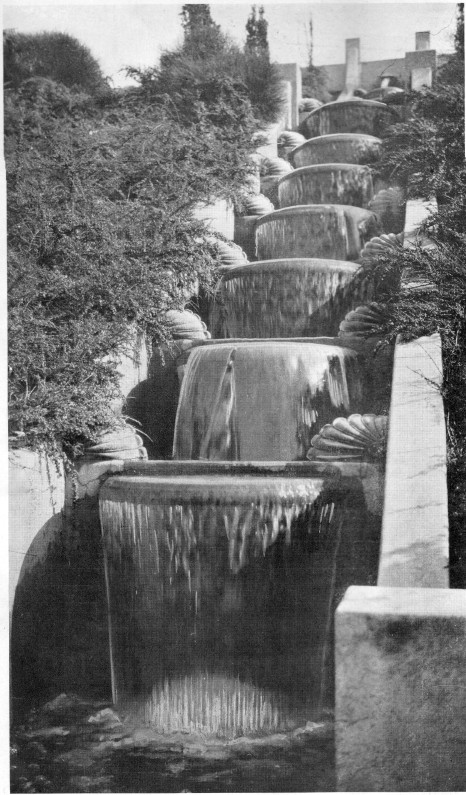
We started at the Cleveland Cascade, a water feature on the shores of Lake Merritt, built in 1923. It fell into disrepair, but a group of neighbors has cleaned it up and is raising money to restore it. Keeping our eyes out for gnomes, we wound our way around to the middle of the Haddon Hill neighborhood. It started as an exclusive development in 1912 by Wickham Havens, son of Frank C. Havens.

We had a longer stop at 552 Montclair Avenue. This c.1897 Victorian was built for Judge Edward C. Robinson and his family, including son Bestor Robinson who was law partners with Earl Warren and led the Sierra Club for many years. The house has lots its "witches hat" and been divided into apartments, and the tankhouse has lost its tank and windmill, but it's still a spectacular property.

Our path took us past the Park Community Garden (the artwork I mentioned, "Her Resilience", has been moved indoors for the rainy season) and a couple of murals, including one by Peter Lee. After walking past several beautiful apartment buildings that date back to the 1920s and 1930s, we stopped to talk about "Borax" Smith.

Francis Marion Smith, known as Frank to his friends, and to his consternation, "Borax" Smith to the rest of the world, was a legendary local of Oakland. After making a fortune in borax (used as a cleanser), he invested in Oakland. He was the force behind the creation of the Key System street cars; the Realty Syndicate (where he partnered with Frank C. Havens) developed areas of Oakland and built the Claremont Hotel. His estate was called Arbor Villa; the row of tall palm trees on 9th Avenue marked one edge of the estate. While the grounds and the magnificent Oak Hall were being constructed, Frank and his wife Mary moved into the "old red house" (currently painted green) nearby. The Smiths entertained and hosted fundraising events in a grand style: "The most brilliant affair of the week of course was the reception which Mr. and Mrs. F. M. Smith gave on Wednesday evening at their charming home, Arbor Villa, in East Oakland, to which over 1300 guests from both sides of the bay were bidden." (April 23, 1899 San Francisco Call).

Mary R. Smith was inspired by reading Benjamin Farjeon's Blade O' Grass about orphans in London, and the Smiths took in a number of young girls. Frank gave her some land nearby, and they set up a trust. The Mary Smith Home for Friendless Girls became home to numerous orphaned girls. The girls lived in cottages, each run by a house mother; the older girls helped take of the younger girls. Many of the cottages, including one designed by Julia Morgan, still stand.

Our final big stop was across from the Haddon Hill home of industrialist Henry J. Kaiser. We also looked at some former steps that used to go from the end of Haddon Rd. down to MacArthur Blvd. Those are closed off, and the statue that graced the plinth is long gone.

Thanks to everyone who came out for the walk! The regular second Saturday walk for March 12th hasn't been set yet, but there will be a special walk on Saturday, March 19th, focused on women's history. Check the website calendar for more info, and hope to see you on the paths!


More photos from the walk here.

Sunday, January 31, 2016

Jack London History Walk


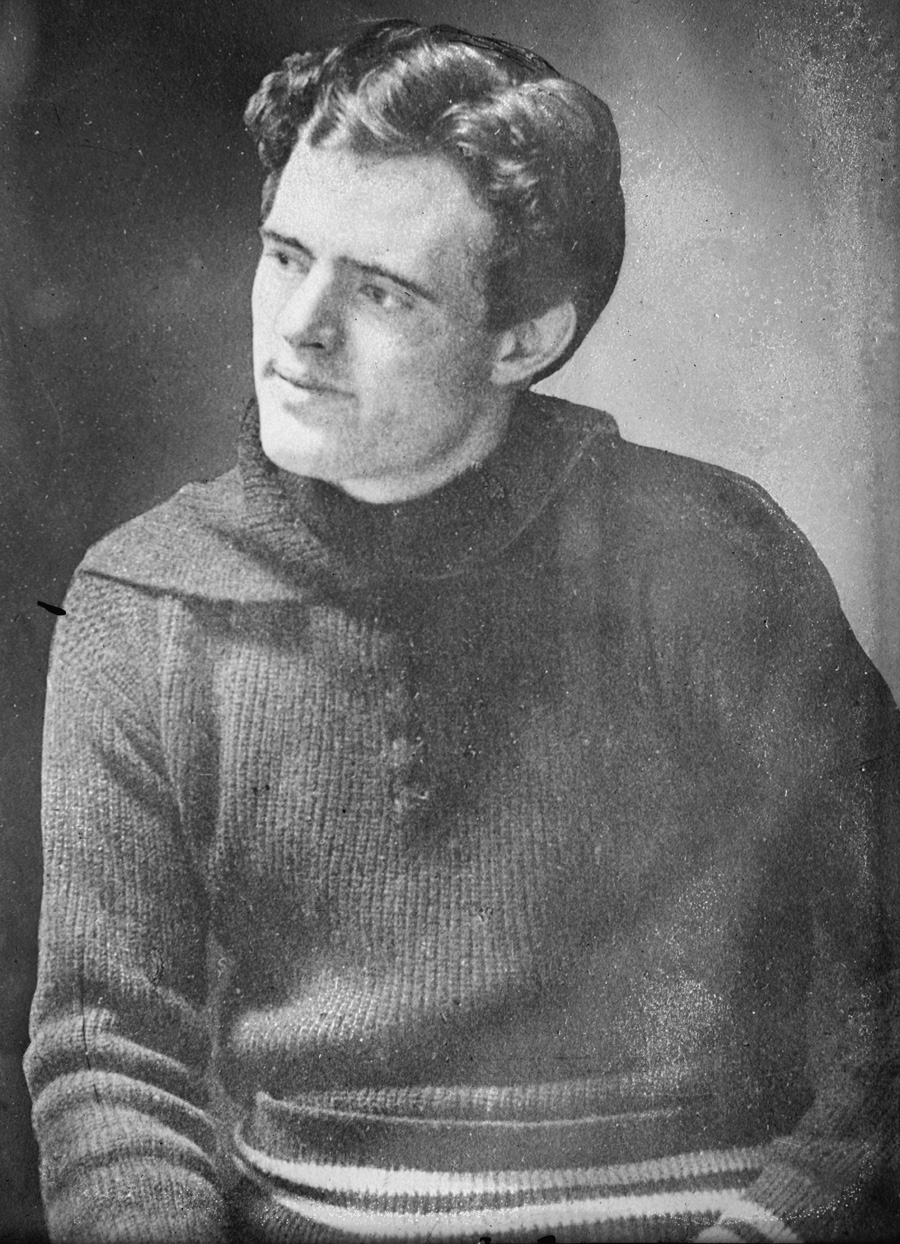
Last Saturday, Oakland Urban Paths and Annalee Allen of the Oakland Walking Tours program collaborated on a special walking tour exploring the Oakland of author Jack London. While Oakland has changed a lot since Jack London's time, there are still a lot of connections to the Oakland he would have known. 71 people (and 2 dogs) braved the chance of rain to join us.

The logical place to start on a Jack London tour is Heinold's First and Last Chance Saloon in Jack London Square. Jack studied there as a child, and based some of the characters in his writing on the sailors and others he saw there. And later, Johnny Heinold loaned Jack the money to attend the University of California (though Jack decided after a year that university wasn't for him.) On the back of Heinold's is a large mural called "Hello Jack" that features things from Jack's life: Jennie Prentiss, the woman born into slavery who did much of the raising of Jack; his cabin in the Yukon; the Snark, his boat that he sailed the South Seas on; Wolf House, the mansion he and Charmian had built in Glen Ellen; and more. The cabin from the Yukon is just beyond the deck of Heinold's. Well, part of it, anyway. Part is in Dawson, part is in Oakland, and pieces have been replaced as needed.

From Jack London Square, we went up to the Oakland Grill, where Jack is featured in another mural, along with other figures from Oakland's history. Then it was up to Lincoln Square in Chinatown, where we talked about Jack and Charmian's South Seas voyages, Jack's photography, his time as a war correspondent, and his portrayal of other races in his writing. Jack was raised by a black woman, but wrote about a "great white hope" to defeat black boxer Jack Johnson; he wrote about the "yellow peril" of Asian immigrants, but also wrote full, rich characterizations of non-whites in some of his novels; etc.

We walked past the Hotel Oakland. When it was completed in 1912, Jack and Charmian had moved to Beauty Ranch in Glen Ellen, but it would have been a notable new presence during his return visits to Oakland. A short distance away is the original site of the University of California. By the time Jack attended in 1897, the university had moved to its newly-built campus in Berkeley. But one of the buildings of the original campus became the Dietz Opera House, the first theater in Oakland. Jack later spoke to audiences there, and the local Socialist party had their headquarters in the building.

On the way to the Jack London Oak in Frank Ogawa Plaza, we passed by the Athenian-Nile Club building. Built in 1901, Jack would have known it, because it was home to the "power elite" of Oakland and was just down from city hall and the Oakland Free Library. The oak tree wasn't planted until one year after Jack's death. Further down 14th Street, we stopped between the African American Museum and Library of Oakland (AAMLO) and the First Unitarian Church of Oakland. We talked more about Jenny Prentiss, who took Jack to church at the First African Methodist Episcopal Church (First AME), and about Jack's first wife, Elizabeth "Bessie" Maddern, who attended the Unitarian church.

Around the corner in Preservation Park, we looked at the Remillard House, where a young Jack London may have been tutored by Lillian Remillard (Dandini) in French. We talked about Preservation Park (one of the Oakland Walking Tours focuses on it), the Latham-Ducel Fountain, and the nearby Pardee Home Museum. These homes and ones like them would have been familiar to Jack. A quick walk took us through Old Oakland, where we looked at other buildings Jack would have known and talked briefly about Mayor John Davie (whose autobiography was titled His Honor, The Buckaroo.)

Heading back towards Jack London Square, we stopped to talk about the Hickmott Canning Company and Cole Grammar School in West Oakland. The Hickmott cannery was at 1st and Filbert, and was where Jack had one of his first jobs—stuffing pickles into jars, for 10¢ an hour, working 12-18 hour days. The noisy, dangerous conditions doubtless helped shaped some his views on workers' rights. Jack attended school at Cole, where J.P. Garlick was principal, and Jack's love of books was apparent: according to classmate Frank Atherton, Jack was "occupied with books. Not only did he apply himself diligently to his studies during class, but also during recess and the noon hour, he would sit on one of the benches in the school yard, reading some strange tale of romance and adventure, while other boys and girls were at play. ...he read many books some seeming far beyond the comprehension of a ten year old boy. And it was remarkable how well he remembered the details of so many stories." And Jack was no stranger in principal Garlick's office. Author James L. Haley in The Lives of Jack London wrote: The leader of the Cole School toughs was a budding young thug named Mike Pinella, who called Johnny a sissy, threw a book he was reading across the schoolyard, and was surprised to learn the "sissy" could hold his own. Both boys ended up in Mr. Garlick's office, who ruled that they would not be punished if they would embrace and make up. Mike Pinella was willing, but Johnny, his keen and growing sense of injustice offended, refused. "I'll take the licking, Mr. Garlick," he said. "I know I was in the right, and I'll do it again if I have to."

A brief rain shower sent a lot of people to their cars or other destinations, but others stuck with us to the end of the walk at the statue of Jack London at the base of Broadway. Thanks to everyone who came out for the walk. We hope to do the walk again later this year, though no date has been set.


Pictures from the walk
:

Thursday, January 14, 2016

Oakland Urban Paths walk: Brooklyn


On Saturday, about 70 people and 5 dogs joined Oakland Urban Paths for a walk exploring the former town of Brooklyn, east of Lake Merritt. There were overcast skies, but we managed to get a break in the (much-needed) rain. Last year local historian Robert Perricone led this walk for OUP, but we changed things up a little this year.

The town of Brooklyn was formed in 1856 by the merger of two smaller settlements, Clinton and San Antonio, and later annexed the town of Lynn just to the north. It was named for the ship Brooklyn which brought Mormon settlers to California in 1846. County supervisor Thomas Eagar suggested the name; he'd been a passenger on the Brooklyn. The town didn't last too long; in 1872, voters approved annexation by Oakland. But it's worth noting that most all of what is now Oakland that wasn't already part of Oakland or the town of Brooklyn was called Brooklyn Township, so an older location name might refer to either.

Next to Clinton Square Park where we met had been the home of Hiram Tubbs, who made his fortune in making rope, and was one of the founders of Mountain View Cemetery. A house built for one of his daughters and son-in-law, the Tubbs-Henshaw House, still stands across International Blvd. Locally, Tubbs was best known for building the palatial Tubbs Hotel, which filled the next block over. Gertrude Stein lived there with her family when they first moved to Oakland. Writer Robert Louis Stevenson stayed there. "Borax" Smith met his first wife Mary at a dance at the Tubbs Hotel (February's walk will be about Cleveland Heights and the former Borax Smith estate.) Unfortunately, the building burned in 1893. The fire department didn't have enough water to fight the huge fire, so all they could do was join the crowd of onlookers and watch the spectacle.

Stein left Oakland in 1891 after her parents died, and didn't return until 1935. During that time, the Tubbs Hotel burned down, the family house was torn down, Oakland's population increased from 35,000 to nearly 300,000, and the bucolic neighborhood where the family had lived was now full of apartment buildings and nearby Highland Hospital. The Oakland of her childhood was gone, and you can't go home again—that's what she meant by "there's no there there".

We stopped and talked about lots of places, some dating back to when it was the town of Brooklyn, and some more recent. One place where we all learned something new as the Vue du Lac Apartments at the corner of Foothill and 3rd Avenue. The building was constructed in 1906 by Charles MacGregor, known as "the builder of Albany" where he constructed about 1,500 homes over the years. He was also called "One-Nail MacGregor", either in a jab at his being overly thrifty, or (more likely) a compliment at the quality of his buildings.

At the Ellen Kenna House, a spectacular Victorian that Ellen Kenna had built in 1888, there were questions about the front door, or more to the point, what appeared to be the lack of one. According to the current owner, "Ellen Kenna owned the block from 12th to 13th Ave. The Valentine Mansion across the street was also situated with its front facing 13th. After Ellen died and it became a hospital, several small homes were built for the staff on the 13th Avenue side (the front). These, too, were eventually subdivided and the stairs coming from the front were awkwardly redirected towards East 21st Street." Alas, he has to sell the home, so while tons of restoration work have restored much of the former glory of the home, he won't have time for the rest of the changes.

Thanks to volunteer Charlie Lenk for helping with the walk, and thank you to him, John Rengstoff and Ed Matney for the use of some of their photos:


Some of the other points of interest and people we talked about include:
Brooklyn
Clinton
Hiram Tubbs
Tubbs Hotel
Tubbs-Henshaw House
Mountain View Cemetery
Intertribal Friendship House
First Swedish Baptist Church
Vue du Lac Apartments
Asa White House
Our Savior Danish Lutheran Church
1819 - 7th Avenue
Tower House
James Presho House
Harbor House Ministries
Clinton Shrine
Quan Am Tu Shrine
Ellen Kenna House
Mother's Cookies
Sunset Telephone Company
St. James Episcopal Church
Brooklyn Presbyterian Church
Brooklyn Firehouse
Fowler Block
Random Parts mural
Olander's Saloon
Brooklyn Basin project
East Oakland Brewing Company
Brooklyn Brewery
Palm Trees
Oakland Gnomes
(And something we don't have an Oakland Wiki page on, the TARDIS, which was seen on a nearby roof.)

There's even more in the area, which we didn't have time to cover, or which only got a brief mention:
Elizabeth Flood
Brooklyn Colored School
Williams Block
John A. Wilds
En El Libro Tu Libertad Mural
Malaquias Montoya
Plaza Theater Teatro
Central Block
Dr. William Bamford House
David Carrick House
Asa Howard House
Palm Terrace
Captain Henry E. Nichols House

Get out and explore on your own! You can also join us on Saturday, January 23rd, for a special walk about author Jack London. Our regular walk on February, 13th, will focus on Cleveland Heights and the former "Borax" Smith estate in Ivy Hill.

Thursday, November 19, 2015

Oakland Urban Paths: Estuary


Nearly 100 people (plus a record 8 dogs) turned out for the Oakland Urban Paths walk exploring the changes along the estuary and the Lake Merritt channel. Led by city planner and WOBO member Ruth Miller, we started in front of the historic Heinold's First and Last Chance Saloon.

We began by viewing some historical maps of Oakland that help show just how much we've changed the shoreline of Oakland over the years. The 1857 map in particular shows clearly that Lake Merritt isn't a lake, but a tidal slough, and much of West Oakland is filled land. (You may also notice that much of Alameda is fill, and that it wasn't originally an island.)

Ruth told us some about Measure DD, a 2002 bond measure that has paid for numerous improvements around Lake Merritt and the estuary. Part of that is to improve the flow of water in and out of Lake Merritt. While the channel won't be as wide as it was in 1857, it is being widened and made more friendly to wildlife and people. We crossed over the channel on the bridge at Embarcadero. Like the other bridges across the channel, this one is slated for replacement, too. The new bridge will be wider and include bike lanes and proper sidewalks, and should provide better clearance for kayaks and other small boats.

Then we went in to the 5th Avenue Marina, a small community of artists in the middle of an otherwise industrial area. They'll be getting some neighbors in the form of the $1.5 billion Brooklyn Basin project, but not all of them are very happy about it. All around them will be shiny new buildings, a mixture of residential and retail, some as tall as 22 stories. The neighborhood will still exist, but how will it be changed?

We then walked up the channel a ways and over one of the pedestrian bridges back to the other side in the midst of the Laney College campus. Ruth told us about more of the Measure DD work, first mayor of Oakland Horace Carpentier and his 'bridge of sighs', and the pottery studio at Laney. From there we followed the channel to 7th Street. We were going to go under the street, next to the 7th Street pumping station, but ironically the walkway was too flooded. The pumping station was built in 1971 because of flooding around Lake Merritt in the 1960s. Now they mostly let the water flow in and out with the tide, but if a big storm is forecast during a high tide, they can bring down the lake level to make room, and even pump against the tide if they need to.

More meandering took us to Victory Court, near the Oakland Fire Department's training center. I told people about what had been there before. It's filled land, but before Laney College was there, it was Frank Youell Field, where the Oakland Raiders played from 1962 through 1965 while the Oakland Coliseum was built. (And did you know the Raiders were almost called the Oakland Señors? It was the winner of a naming contest, but fortunately didn't go through.) And before the football field was the Auditorium Village Housing Project, "temporary" housing built for some of the many people who came to work in the Bay Area shipyards during WWII. That's where Victory Court got its name. (The WWII housing project in West Oakland that someone asked about was the Harbor Homes Housing Project.)

A few people returned to Heinold's for more talk and a post-walk beer (though Heinold's didn't open until close to 1PM, instead of 12-ish). Another great walk! Thanks to everyone who came out, and special thanks to Ruth Miller for guiding us on the walk. The location of next month's walk is to be determined, but it will be the 2nd Saturday, December 12th at 10AM.

More pictures from the walk. Thanks to volunteer Charlie Lenk and walk participant Ethan Lavine for the use of some of their photos.

Monday, July 13, 2015

Oakland Urban Paths: Montclair and the Sacramento Northern Railway


Note: Many of the links below are links to OaklandWiki.org, where you can find more information about the subjects. At the end of the article there are some additional links to other sites I mentioned, plus a link to a map of our route.

Saturday we had about 50 people (and two dogs) turn out for a walk exploring Montclair and the Sacramento Northern (SN) Railway with Oakland Urban Paths. The Sacramento Northern was an all-electric railroad running from Oakland to Sacramento to Chico.

We started in Montclair Park near the duck pond. From there you can see some traces of railroad, including the bridge abutments on Mountain Blvd. We headed up Moraga Avenue to the nearby Montclair Firehouse. The lovely storybook structure hasn't been used since the 1989 earthquake, because it's seismically unsafe, and the Hayward fault is basically out its front door. There are some people who'd like to turn it into a firefighting museum, but without a lot of money that's not going to happen soon. From there we headed to the corner of Moraga and Thornhill Road, and I showed people a picture of an SN train crossing the bridge that used to be there.

Then we walked over to Fernwood Drive, which is named for the historic estate that once filled the valley. It first belonged to Jack Coffee Hays, who gained fame as a Texas Ranger hunting down the Comanche people. After a stint as San Francisco sheriff, he moved to Oakland. He improved the county road that is now Moraga Road to access his estate; for many years the area was known as "Hays Canyon" or "Jack Hays Canyon". After Hays' death, his widow sold the beautiful Fernwood estate to William Dingee of the Oakland Water Company.

A bit of backtracking took us to the Montclair library, another local storybook gem, and the Montclair Women's Club. We talked a bit about the controversy surrounding it. After decades as a women's club, it's been sold, and a group wants to put in a Montessori school. Nearby neighbors are concerned about the increased traffic, because there are two elementary schools within a half mile of the already busy intersection.

Then it was up our first flight of stairs to Cabot Drive. If you approached from the top, you might think you were trespassing, but the stairs are a public right of way. They're just unmarked, so you have to know that they're there. We walked down the hill to Mountain past one of the elementary schools, then climbed another flight of stairs up to Magellan Drive.

Finally, we dropped down to the Montclair Railroad Trail. This follows the actual right of way that the trains followed, and so has a very gentle grade and wide curves. We viewed one of the information signs about the SN, and another about Highway 77, the highway that fortunately was never built up Shepherd Canyon. We walked a bit further up, and I talked about the tunnel that the trains went through to get over to the Moraga side of the hills.

We backtracked, then went through Montclair Village and checked out some of the new murals. Including some in the first-ever-OUP parking garage traversal, as several of the latest murals are inside. We crossed Highway 13, climbed up to Bruns Court, then returned to our starting point via a pedestrian bridge back over Highway 13 (and Hayward fault!).

Thanks to everyone who came out for the walk and for your donations, and special thanks to those who carried the loudspeaker and clipboard for me at different points. Hope to see you on the paths again soon!

Additional Links

  • East Bay Hills Project - Stuart Swiedler's amazing web site with lots of photos of the Sacramento Northern
  • Sacramento Northern on the OB&E - Daniel Levy's great web site with photos and more, including info about the Key System and other local transit. Daniel was the Eagle Scout behind the project that placed the informative signs along the SN right of way
  • Western Railway Museum - a museum near Rio Vista on the way to Sacramento. They've preserved some of the engines and cars of the Sacramento Northern (as well as the Key System)

Our Route

A Google map of our route.


More Photos

Some more photos, both from the day of the walk and other

Wednesday, June 17, 2015

Oakland Urban Paths: Laurel to the Redwoods


This past weekend was the monthly Oakland Urban Paths walk. Saturday a group of about 60 people (and 6 dogs) joined us for a strenuous, somewhat less urban hike from Laurel up into the redwoods of Leona Heights Park. The walk was led by local historian Dennis Evanosky.

As we wound our way along streets and pathways, Dennis told us about some of the local history including the granting of Rancho San Antonio to Luis Maria Peralta by the Spanish government. Peralta never lived on the nearly 45,000 acre land grant, but his four sons did. Peralta was given everything from the water's edge to the crest of the hill, except for the port and the redwoods which the government kept for themselves.

Our route took us through George E. McCrea Memorial Park, which is home to some fly-casting pools. The park was originally nearby next to the McCrea family home on what is now part of Holy Names University. A pedestrian bridge took us across Highway 13, and it was into Leona Heights Park. The trail follows the stream, and starts off fairly wide and easy to walk on. At one point, the WPA crews didn't go any further, and the trail becomes narrower, steeper and unsurprisingly, less well maintained. But most people (and dogs) stuck with us. We stopped at one point to look at an albino redwood tree, and Dennis told us about the cutting of the redwoods and how they were transported to the sawmills.

More climbing took us up to a fire road, and from there we could see out across the bay. We also saw the Old Survivor Redwood Tree, one of the few trees in the area to not be cut 150 years ago. A core sample was taken years ago by city naturalist Paul Covel, and it's estimated the tree is about 450 years old. We followed the fire trail down the hill, past the old sulfur mine, and got views of the previous location of the Chabot Observatory. The newer Chabot Space and Science Center near Redwood Regional Park opened in 2000, but the first location of the observatory was downtown, in what is now Jefferson Square Park.

The return to our starting point took us past the Home of Peace, which was started by the Montgomery family in 1893 as a waystation for missionaries. Special thanks to Dennis for leading the hike, and thanks to everyone who came out for it! Be sure to look for Dennis' various local history books next time you're at Laurel Bookstore downtown at 14th and Broadway.

Lots more pictures from the hike:


An approximate map of our route on Google Maps.

Sunday, March 15, 2015

Oakland Urban Paths: Highland Terrace


Saturday 40 people joined Oakland Urban Paths for a walk exploring the staircases of Highland Terrace and several parks near Reservoir Hill. We had unusually humid and warm weather, so it was fortunate the sun was partially blocked by clouds.

We started our walk in front of Highland Hospital, which back in the days of the Key System, had its own stop built in the style of the hospital. From there we went up and down several stairways from 14th Avenue to the streets above. A few of the residences can only be accessed via the stairs. Our route took us past numerous beautiful Victorians and a few that are in need of some attention. There were also countless barking dogs, which is why we had the unusual 'no dogs' request for this walk.

Along the walk was the John C. McMullen House. McMullen was a well-to-do lawyer and banker who had the home built in the late 1800s. When we got there, we heard from the current owner, who has lived there since he was two years old and is slowly restoring the home to its former beauty.

From there we wound our away through several Oakland parks, the Central Reservoir Recreation Area and William D. Wood Park. As you might guess, the first is near the Central Reservoir just below I-580. Less well-known is that Wood Park was formed because of leakage from the reservoir. In the 1950s it destabilized the hillside and took out a dozen homes and part of McKillop Street. The area wasn't turned into a park until 1976. And oddly enough, in the 2000s, more seepage took out some more homes.

We looped around the reservoir, crossed I-580 twice, then wound our way back to our starting point, with different views of Highland Hospital, the palm trees of Borax Smith's Arbor Villa estate where we walked in February, and other unexpected sights. The walk for April is yet to be determined, but hope you can join us Saturday, April 11th at 10am wherever in Oakland it is!

View some pictures from Robert Perricone.

Special thanks to Eric Nomburg for the use of some of his photos. More pictures of the walk:

Friday, March 13, 2015

Oakland Women's History Tour

This past Sunday we had a great turnout for a Women's History Tour around downtown Oakland, led by historian Annalee Allen of the city's Oakland Walking Tours and co-sponsored by Oakland Urban Paths. 60 people (and two dogs) met up in front of city hall for a walk through Oakland to learn about some of the amazing women who have called it home.

Our first stop was near the Rotunda Building, originally known as Kahn's Department Store. There a plaque remembers the women of the 1946 Oakland General Strike, which shut down the city completely. Near the Jack London Oak tree we heard about about Jack London and the woman who raised him, Jennie Prentiss, a woman who had been born into slavery.

Then it was on to the first of several beautiful murals we were to see. Mitzvah: The Jewish Cultural Experience is 7 stories tall, and features people and scenes from Jewish history from Oakland and beyond. Two of the people included in the mural are Gertrude Stein and her life-long partner, Alice B. Toklas. Kitty Hughes from the Oakland Heritage Alliance told us more about Stein, her growing up in Oakland, and the infamous "there is no there there" line from her book, Everybody's Autobiography published in 1937. The line refers to Stein's childhood experience being completely gone. The magnificent Tubbs Hotel where the Steins first lived had burned down; the bucolic neighborhood where the Stein's lived was now built up with numerous homes and apartments, and the population of Oakland had grown from 35,000 in 1880, to nearly 300,000 by 1935 when she returned.

A walk down Mural Lane took us to the former YWCA Building, designed by talented and prolific Oakland architect Julia Morgan, then to the site of the former Ebell Society clubhouse, and finally to what is now the Malonga Casquelourd Center for the Arts. It was originally built as the Oakland Women's City Club, then became the Alice Arts Center, so named because it's on Alice Street. Alice Street is one of the few streets downtown not named for a dead white guy; instead it's named for Alice Carpentier, sister of Oakland founding scoundrel Horace Carpentier. There we met up with Jerri Lange, pioneering Bay Area journalist. She's one of the many people featured on the amazing mural across Alice Street, including center namesake Malonga Casquelourd.

Jerri later met up with us at our final stop, Camron-Stanford House next to Lake Merritt. It was home to various families over the years, including the Camrons, the Hewes, and the Stanfords (Josiah, brother of Leland). But more recent Oaklanders know it as the Oakland Public Museum, one of the predecessors of the Oakland Museum of California. There we heard from Reenie (one of the docents who was on the walk with us), Ann Swift (executive director) and several of the docents about the truly amazing women of the Ebell Society. I highly recommend checking out the great exhibit about the Ebell Society that Camron-Stanford House has put together.

Another great walk, and thanks to Annalee for leading it!

More photos from the walk:

Monday, February 16, 2015

Oakland Urban Paths: Cleveland Heights and "Borax" Smith


Saturday we had amazing weather for an Oakland Urban Paths walk exploring Cleveland Heights and the nearby former estate of F. M. "Borax" Smith. This was a good follow on to last month's walk in the former town of Brooklyn just south of Saturday's walk.

During the walk I mentioned a Oakland map website that has a series of maps of Oakland, from 1877, 1912, 1936, 1950s, 1967 and present day. It's a great way to see how Oakland has changed over the years. If you look at the 1912 map, you'll see the outline of "Borax" Smith's estate, Arbor Villa. The portion of the map shown here is even older, from about 1869, before Oakland annexed Brooklyn in 1872.

I also promised to provide a map in lieu of the one I didn't have ready for Saturday. Here's a link to a Google map with our route shown, but also some of the points of interest along the way, and as an added bonus, it also shows the approximate bounds of the Smith's Arbor Villa estate and of the Mary R. Smith Home for Friendless Girls.

We started the walk at the Cleveland Cascade, designed by landscape architect Howard Gilkey and built in 1923. It was likely shut down during WWII, but was reactivated after the war. At some point it was turned off, fell into disrepair, and became overgrown and full of trash. In 2004, a group of neighborhood volunteers including Barbara Newcombe uncovered and cleaned up the cascade. Since then they've put in new railings and lighting, and are raising money to restore the water portion of the cascade. If you want to help, the Friends of the Cleveland Cascade has garden work parties on the first Saturday of each month.

From there we meandered across Cleveland Heights, keeping an eye out for gnomes, sidewalk stamps, murals and other things. We eventually crossed over Park Blvd. into the Ivy Hill neighborhood, and what was once the estate of "Borax" Smith, Arbor Villa. While the 42-room Oak Hall, gardens, out buildings and observation tower are all gone now, a row of palm trees marks one edge of what was once the estate. Seeing an old palm tree in Oakland is often a good sign that someone notable lived nearby, but the Arbor Villa palm trees are the best example.

Then it was back across Park Blvd. and along some buildings that are left from the Mary R. Smith Home for Friendless Girls. Frank's first wife, "Mollie", was inspired by Benjamin Farjeon’s Blade O’ Grass about orphans in London, and started an orphanage for girls. One of the "cottages" is an impressive structure at 3001 Park Blvd., which was designed by noted architect Julia Morgan. Our route back to the Cleveland Cascade took us past a home once owned by industrialist Henry J. Kaiser, some stairs at the end of Haddon Rd. that are no longer accessible, and down some beautiful stairs to Beacon St.

Another great walk! Thanks to everyone who came out for the walk, and to Tim for carrying the speaker. In March, we'll have two walks, our regular second Saturday walk (location to be determined) and a special Women's History Walk led by local historian and writer Annalee Allen. Hope to see you there!

Lots more pictures from the route (some taken during the test walk):

Sunday, January 18, 2015

Oakland Urban Paths: Brooklyn


This post is a week late because I've been busy working on the Legendary Locals of Oakland book. Also note that I included some pictures in the slideshow at the end that are from when I did the test walk. It's all things we saw on Saturday (except the cat and the squirrel), but that I didn't have time to take during the walk.

“Oakland is nobody's Brooklyn, but part of Oakland was once Brooklyn.”

We had an amazing turnout for last Saturday's Oakland Urban Paths walk exploring the former town of Brooklyn. About 100 people and 8 dogs joined us as local historian Robert Perricone showed us around what was once a separate town east of Lake Merritt. Brooklyn was named for a ship that brought Mormon settlers to the area, not (directly) for the city in New York.

We started the walk in Clinton Square Park, which is another name from history. Moses Chase was the first American citizen to settle in what is now Oakland. He left his fiancee Mary Ellen Clinton to seek his fortune in California. After falling ill in the gold fields, Chase settled east of Lake Merritt and founded the town of Clinton, named for his fiancee. Sadly, she died before he returned to marry her. The town of Brooklyn was formed in 1856 by joining the settlements of Clinton and San Antonio.

We wound our way around various sites, some dating back to the town of Brooklyn or early Oakland, and some modern ones. Our final stop was one major building that's no longer there, the Tubbs Hotel. It was a large, luxurious hotel, which covered the entire city block. Gertrude Stein's family lived there for almost a year when they first moved to Oakland. As happens with many large, wooden structures, the Tubbs Hotel burned. There wasn't enough water to fight the fire, so the fire became a spectacle with people coming to watch.

Stein left Oakland in 1891 after her parents died, and didn't return until 1935. During that time, the Tubbs Hotel burned down, the family house torn down, Oakland's population increased from 35,000 to nearly 300,000, and the bucolic neighborhood where the family had lived was now full of apartment buildings and nearby Highland Hospital. That's what she meant by "there's no there there".

Thanks to everyone who came out for the walk, and many thanks to Robert for leading the walk. Below is a slideshow of photos, and below that are more links to the Oakland Wiki about some of the things we saw and talked about.

Pictures from our walk:

Wednesday, December 17, 2014

Oakland Urban Paths: Lakeshore to Piedmont Ave.

Saturday was our monthly Oakland Urban Paths walk, this time going from Lakeshore to Piedmont Avenue and back again. It's a walk we've done before, but there were a few changes. About 35 people and 5 dogs joined us some perfect weather to explore Oakland.

From our start in Mandana Plaza, we climbed over the hill behind the Grand Lake Theatre, and around past the former Lakeview Elementary School. From the unusual pedestrian bridge over I-580, it's easy to see what an impact the freeway (completed in 1966) had on the school (built in 1913). The school is now closed, and OUSD uses the space for offices. Over the bridge took us into Adams Point, named for Edson Adams, one of the 'founding scoundrels' of Oakland. For those that were wondering, Jayne Avenue is named for his wife, Hannah Jayne, who was Oakland's first school teacher.

Several sets of stairs took us through the Harrison-Oakland / Harri-Oak neighborhood, down to Glen Echo Creek. The creek is also known as Cemetery Creek where it begins up in Mountain View Cemetery. It winds its way (sometimes in a culvert) all the way down to Lake Merritt, where it feeds in near the Veterans' Memorial Building.

We walked over to Piedmont Avenue, and planned to meet up in Key Route Plaza after a short break. There we were disappointed to find that the wonderful Key Route Plaza mural by Rocky Rische-Baird had been destroyed. A new tennant, KronnerBurger, is moving into the space that used to be J's Mexican American Diner. They said later on Twitter that the wall wasn't properly supported (true, but fixable) and covered with black mold (possibly true, but also fixable). However, they made no effort to preserve the mural, and the artist and neighborhood residents are understandably upset.

We walked back towards our start along a different route, visiting some different sections of Glen Echo Creek. We eventually came to the Morcom Rose Garden, named for former mayor Fred Morcom. Up the hill on Jean Street took us to the top of some nice stairs, which led us down to Grand Avenue. From there, the Davidson Way steps took us back up the hill, then it was a short walk back to our starting point on Lakeshore.

Another great walk. Thanks to everyone who came out. The January walk is still being planned, but may be a walk around the former town of Brooklyn just east of Lake Merritt. Hope to see you then!

Lots more pictures from the walk: